The images of these maps above can be found on the following website.
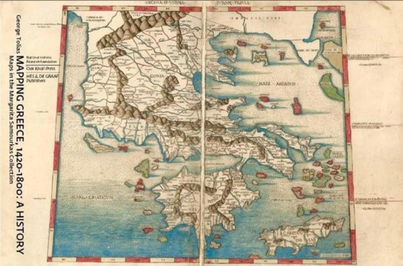
Based on the colouring and the overall appearance, one of the maps from this atlas must have been used for the cover of the book Mapping Greece,1420-1800: A
History Maps in the Margarita Samourkas Collection written by George Tolias. This cover is shown on the picture below.
In the years 2008 and 2009, some beautifully coloured and gold heightened maps of a Rome Cosmography edition passed by.

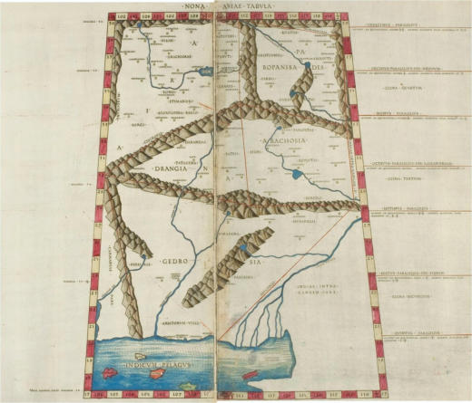
The 1478, 1490, 1507 and 1508 Rome editions of Ptolemy's Cosmography
including the Ruysch world map and their watermarks
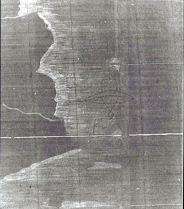
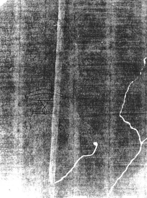
Quite a few of these maps passed our hands. We discussed many facets and took some x-rays of these maps for further research and for the watermarks. The x-rays
we took of the two coloured maps above, are presented below. They clearly show that the maps contain the watermark cardinal's hat. In total, we have seen or have
information of about ten of these very specifically and identically coloured maps. They all contained either a comparable variant of this type of the watermark cardinal's
hat or no watermark at all.
Additionally, painted structures such as the rivers, a coloured margin of the map and the coastline are visible on these x-rays. This means that the paint applied to
colour them must have contained lead white which is nowadays prohibited to use in paint. Therefore, it can be concluded that these maps must have been old and
contemporary coloured. The patina clearly visible on the colour photos acknowledges this. It certainly does not point to a modern colouring.
We also found, on the internet, images of the world map that belonged to this atlas and these regional maps.
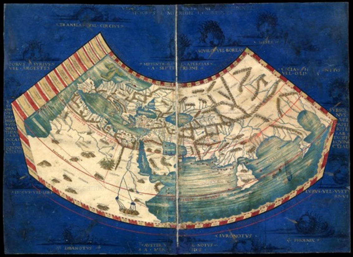
This world map provided some extra information. The windfaces are not printed, but painted on this map and their names are gold heightened. The style in which the
windfaces were painted, is indicative of the first half of the sixteenth century. The rich and costly illumination indicates that this copy was in possession of, or at least
intended for, a high ranked person. According to us, the patina of this map is another feature characteristic for old or contemporary applied colouring.
Nevertheless, it still was not clear to which edition these maps belonged.
Therefore, we started a research project. We visited a number of libraries and institutions in Europe and we received a lot of information and photos from libraries
and institutions in the United States of America. This resulted in two publications about the different Rome editions and the Ruysch world map in Quaerendo,
a peer reviewed scientific journal concerning book science. These are mentioned under the tab Publications above, including the website where they can be
downloaded.
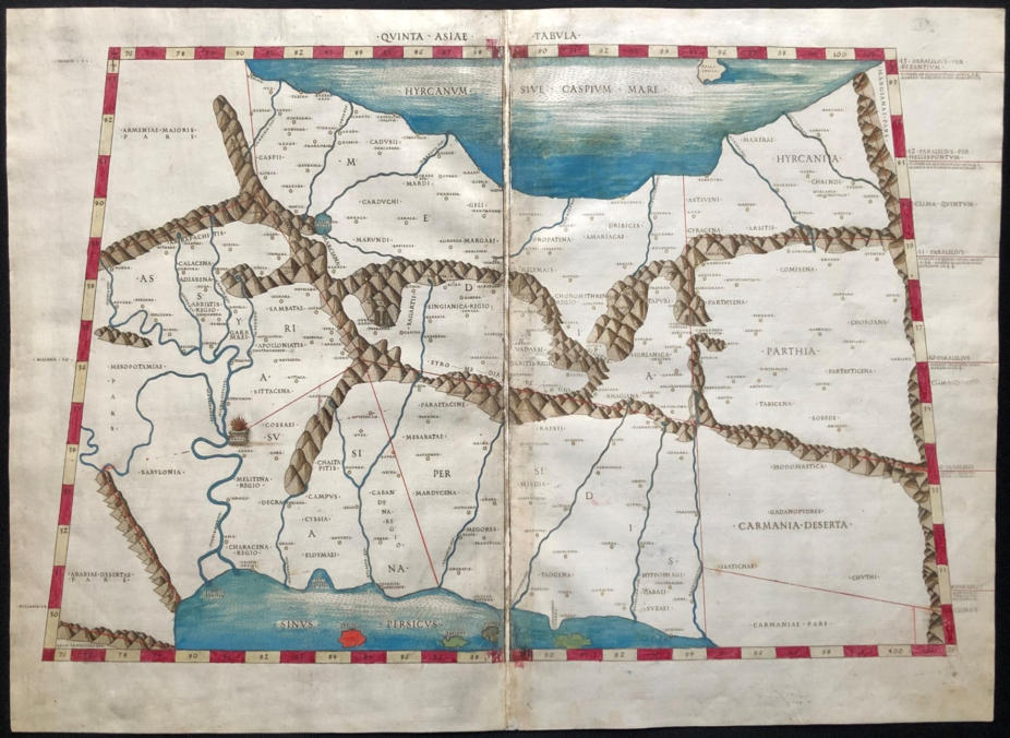
We now know that these maps belong to the second edition of the Rome Cosmography published in 1490 by Petrus de Turre. During our research we found
very few coloured examples in all studied atlases. If they were coloured at all, it was fairly basic.
On the regional maps, gold heightening was applied to the circles representing the places and historic symbols or monuments and woods.
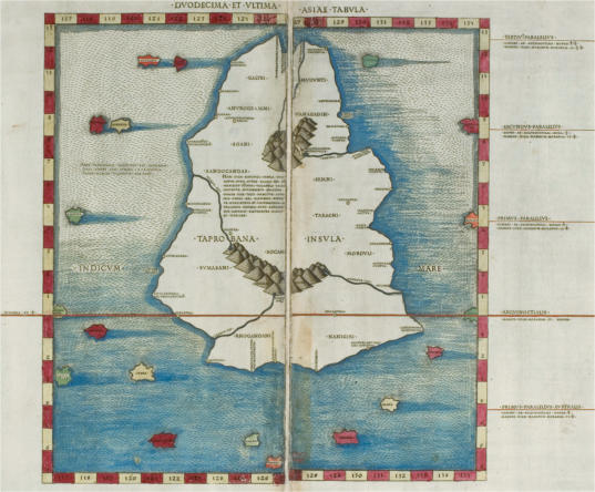
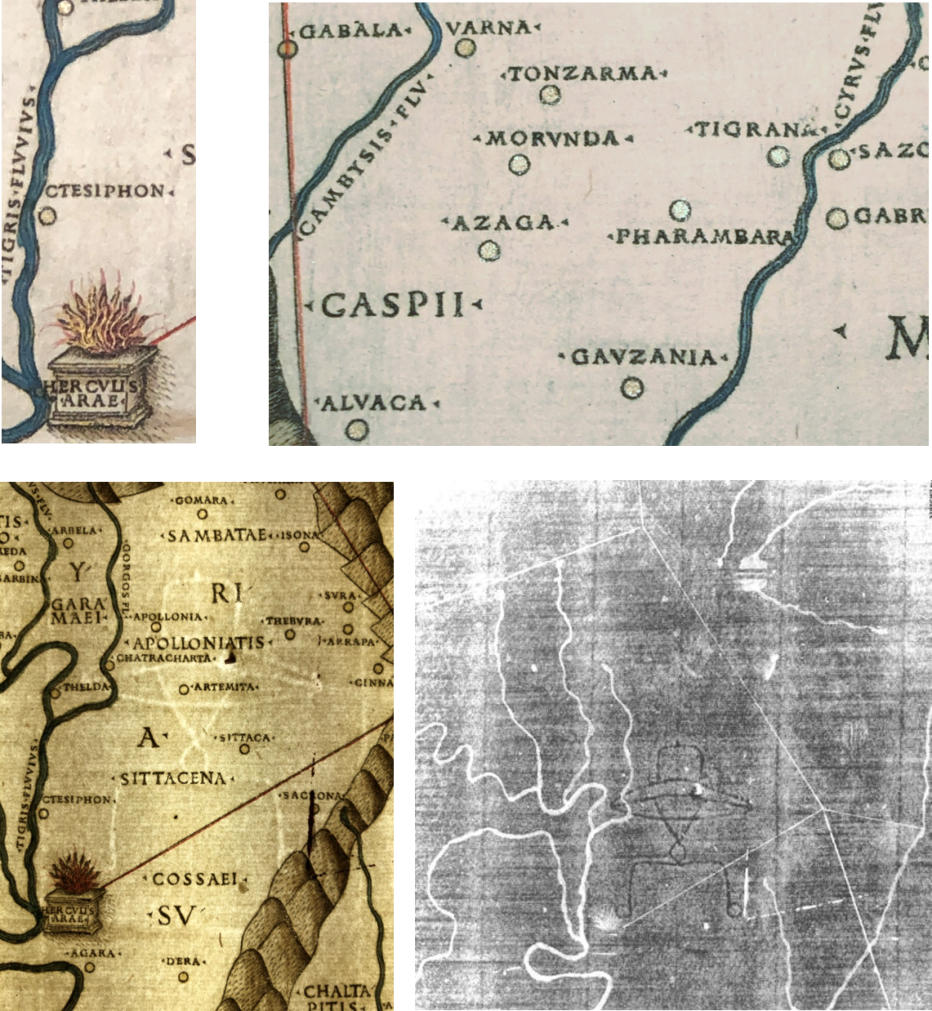
We added the picture of one more map, together with some photos of details, the watermark, and the x-ray of unmistakenly this map. This is proven by the
gold heightened historic element Herculis Arae, clearly visible on the colour photo as well as on the x-ray. On this x-ray, the gold heightening applied to the circles
used for the places is also perceptible.
Thus, it can be concluded that these map belong to the 1490 edition of the Rome Cosmography, that they were old or contemporary coloured and that they were
gold heightened. This makes these maps very special or rather unique.
© 2021ROBERT PEERLINGS